
Iceland’s Volcanoes Are Quiet — But Magma Continues to Build Beneath Reykjanes
The surface on Reykjanes is quiet, but the Icelandic Meteorological Office says magma is still accumulating beneath Svartsengi – and the volcanic episode has not been declared over.
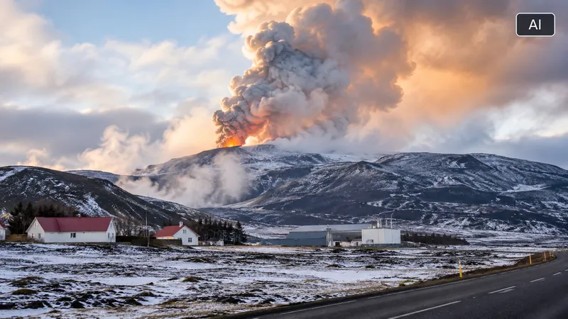
The Reykjanes Peninsula in southwest Iceland is experiencing a relatively quiet period on the surface, but the latest monitoring data show that magma continues to accumulate beneath Svartsengi.
In its latest assessment, published on 27 October, the Icelandic Meteorological Office confirmed that ground uplift is continuing at a relatively steady rate. Scientists say another underground magma intrusion towards the Sundhnúkur crater row remains the most likely next development while the uplift continues. Such an intrusion could lead to another volcanic eruption.
Although earthquake activity along the crater row remains low, a magnitude 2.5 earthquake was recorded near Víkur, west of Grindavík, on 14 October. The Meteorological Office says it is thought to be associated with increased stress in the Earth's crust caused by continued ground uplift.
The timing of any further activity remains uncertain. The latest assessment does not indicate that an eruption is imminent, but it also provides no basis for considering the volcanic episode over.
Ground uplift continues beneath Svartsengi
Deformation measurements continue to show ground uplift in the Svartsengi area. According to the Meteorological Office, models based on these measurements indicate that the volume change beneath the area is continuing at a relatively steady rate.
The uplift indicates that pressure is continuing to build within the magma accumulation zone, several kilometres beneath the surface.
Satellite-based InSAR measurements covering the period from 11 August to 16 October 2026 also show continued ground deformation at Svartsengi. These measurements allow scientists to identify changes in the Earth's surface by comparing radar images taken from satellites.
The latest monitoring graphs published by the Meteorological Office were updated on 30 October, providing further current data for monitoring the development beneath the area.
An earlier assessment, published on 30 September, recorded approximately four centimetres of ground uplift over the preceding three months. That figure belongs to the September reporting period and should not be interpreted as a new measurement for October.
Earthquake activity remains low, but stress is building
Seismic activity within the magma dike beneath the Sundhnúkur crater row remains low, according to the latest assessment.
However, the area near Víkur, west of Grindavík, has experienced some earthquake activity. A magnitude 2.5 earthquake occurred there on 14 October, making it the largest recorded in that area since June.
The Meteorological Office believes this activity is connected to increased stress in the Earth's crust around Grindavík as the ground continues to rise at Svartsengi.
This distinction is important. Low earthquake activity along the magma dike does not mean that magma accumulation has stopped. Ground deformation and seismic measurements provide different pieces of information about what is happening beneath the surface.
Scientists therefore continue to assess the situation using several monitoring methods rather than relying on earthquake activity alone.
Why the Sundhnúkur crater row matters
The Sundhnúkur crater row, near Grindavík and the Svartsengi geothermal area, has been the focus of repeated volcanic activity since December 2023.
The most recent eruption in this sequence began on 16 July 2025. Since then, monitoring has continued to show magma accumulating beneath Svartsengi.
The Meteorological Office identifies a new magma intrusion from the accumulation zone towards the Sundhnúkur crater row as the most likely scenario while ground uplift continues.
Such an intrusion could lead to an eruption, although this is not guaranteed. The movement of magma underground does not automatically mean that it will reach the surface.
The authorities also warn that the interval between events makes the timing increasingly difficult to predict. Previous intrusions and eruptions have been preceded by relatively short warning periods, and a short warning period must still be expected.
The volcanic episode has not been declared over
The latest assessment provides no indication that the ongoing eruptive episode along the Sundhnúkur crater row is coming to an end.
The Reykjanes–Svartsengi volcanic system remains at alert level 2, described by the Meteorological Office as “Considerable increase in activity” (orange).
For the episode to be considered over, monitoring data would need to show clear signs of declining activity over an extended period.
The Meteorological Office also points out that magma accumulation can continue or resume after a pause. Long intervals without an eruption are therefore not, on their own, evidence that the volcanic episode has ended.
The current hazard assessment map remains valid until 5 January 2027, unless changing conditions require an earlier reassessment. The map is based on a range of monitoring data that are continually updated.
What this means for residents and visitors
The main message remains that a quiet period at the surface should not be confused with an all-clear.
There is currently no reliable way to predict when another magma intrusion might occur or whether it will lead to an eruption. However, continued ground uplift means the volcanic system remains under pressure, and the possibility of another event must be taken seriously.
Residents and visitors should follow official hazard assessments, warnings and access restrictions. Conditions can change, and older reports should never replace current safety information.
For the latest information, consult the Icelandic Meteorological Office and Iceland’s Department of Civil Protection and Emergency Management.
The latest assessment describes a volcanic system that remains active beneath Svartsengi, even while the surface appears relatively calm. Magma continues to accumulate, the possibility of another intrusion remains, and the timing of the next event is still uncertain.
Sources
- Icelandic Meteorological Office – updates on the Reykjanes Peninsula
- Department of Civil Protection and Emergency Management
Editorial note — 30 October 2026: This update is based primarily on the Icelandic Meteorological Office's assessment published on 27 October 2026, together with its monitoring data updated on 30 October. The article also retains the historical ground-uplift measurement published in the Office's 30 September assessment, clearly identified as an earlier measurement. The earthquake near Víkur, the continued ground deformation, the current alert level and the hazard-map validity are attributed to the Meteorological Office. The article does not claim that a new eruption is imminent or that the latest monitoring graphs establish a prediction. The AI-generated landscape image is illustrative, not a documentary photograph of a verified location or current volcanic conditions.
Tips, corrections or questions: ritstjorn@frettir247.news
More from Iceland
 ICELAND · IMFIceland Takes the Floor for Eight Nations: Ásgeir Jónsson Presents Nordic-Baltic Position at IMF Meetings31 October 2026
 ICELAND · FOREIGN AFFAIRSUS Secretary of State Marco Rubio Visits Iceland: Höfði Hosts a New Chapter in Iceland-US Relations30 October 2026
 ICELAND · NEWSPower Outage Reported in Laugarás as Crews Search for Fault14 October 2026